
Construction / Progression
Construction / Progression
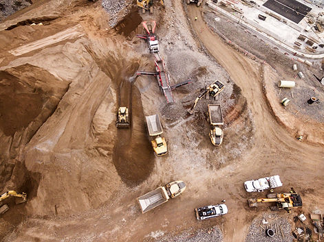
Jersey Drone Photography Provides Custom Web Pages, Aerial Photography, 2D/3D Mapping, 360 Views, and Video Services for Construction Sites.

Drone photography and video also provides a safe vehicle for site inspection, delivering real-time data from dangerous areas and helping contractors mitigate problems before they worsen. By using drone photography in construction projects, contractors and site managers have an affordable method for obtaining actionable information and visual collateral that leads to smarter business decisions throughout the construction process.


These days, contractors are leveraging drone photography to efficiently manage construction projects. With aerial photography, stakeholders get a comprehensive overview of the jobsite, from planning to completion, visually documenting and monitoring activities along the way. This comprehensive overview aids in robust project and time management, saving dollars and pleasing clients. Helps keep projects on schedule and on budget.
What is an Orthomosaic Map?
An Orthomosaic Map is an aerial photograph comprised of dozens, hundreds, or thousands of smaller overlapping images, typically captured with a drone or UAV. These images are “stitched together” with specialized photogrammetry software resulting in an Orthomosaic Image that has been “orthorectified” or geometrically corrected to provide uniform scale throughout allowing for accurate measurement of distance.
Orthophotos, as they’re also called, are similar to what you’d see in Google Maps but with much higher detail and accuracy, allowing users to zoom in and out without distortion, providing numerous uses for Agriculture, Construction, Real Estate, Emergency Services, and more.

